 Stage 1 Osborne – M2 Connector
In 1955, the great South Australian visionary, Premier Tom Playford, oversaw the growth and development of SA identifying that one key element for successful growth – plentiful and cheap land. The world-renowned city of Elizabeth, 25 kms north of Adelaide, saw the perfect balance of residential, commercial, industrial and recreational development. It was, and remains, a lasting testimony to Playford’s vision.
Similar projects in both size and scope will be required to ensure that the people and support industries for SA’s new maritime sector will be there.
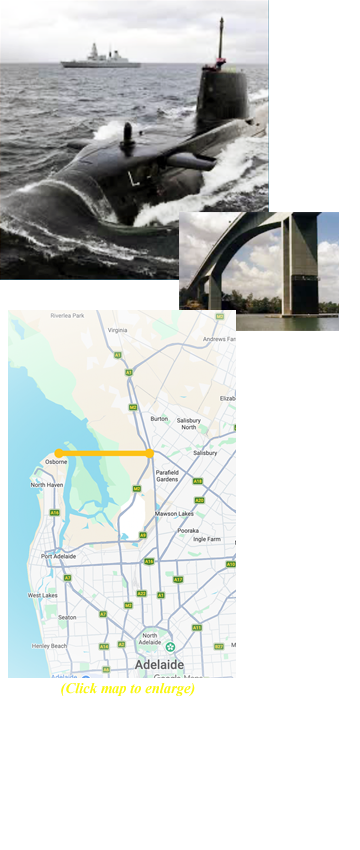
Elizabeth-style cities and ‘MATS Plan’ style transport access to the shipyards, will ensure the necessary infrastructure and supply lines to Adelaide’s north can provide the land, and a new world-class gateway bridge over the Port River and Barker Inlet can connect the naval precinct with the northern Adelaide plains.
Such a bridge and road system – on land the Government currently owns – would provide essential access to housing, supply chains and tourism opportunities – not to mention its proximity to the Edinburgh military air base.
The cramped suburbs around Port Adelaide are already under unsustainable pressure. Grand Junction Road is at maximum capacity. More traffic congestion, air pollution, the destruction of bio-diversity (bulldozing tree-lined streets and low-density housing) or increasing pressure on electricity, water, sewage, or stormwater infrastructure, in other words more urban densification of Port Adelaide-Enfield would be a disaster.